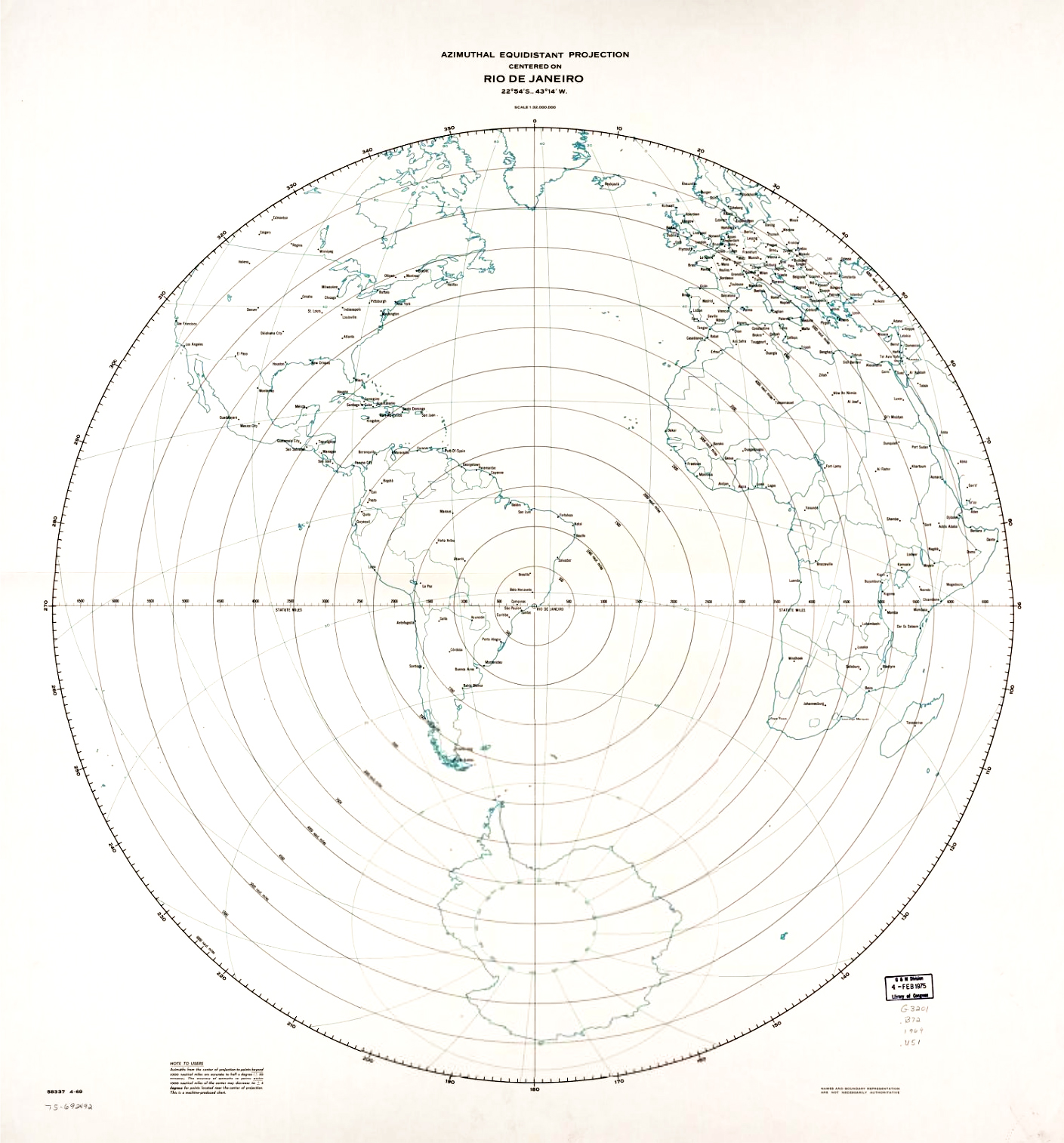
World Map centered in Rio de Janeiro
Subject
Azimuthal equidistant projection centered on Rio de Janeiro
Location
Rio de Janeiro, Brasil
Year
1969
Coordinates
22°54'0"S 43°14'0"W
This map uses an equidistant azimuthal projection. This type of projection consists in defining a central point and represent each point of the map at a correct proportional distance from the defined center. The flag of the United Nations is created using this projection. This type of projection is useful in terrestrial communication to simply find the points closest to an antenna for example. But it is also used in the army services to show ranges of missiles.

No comments yet — be the first to share your thoughts.