The Russian Maze, a Geographical Game
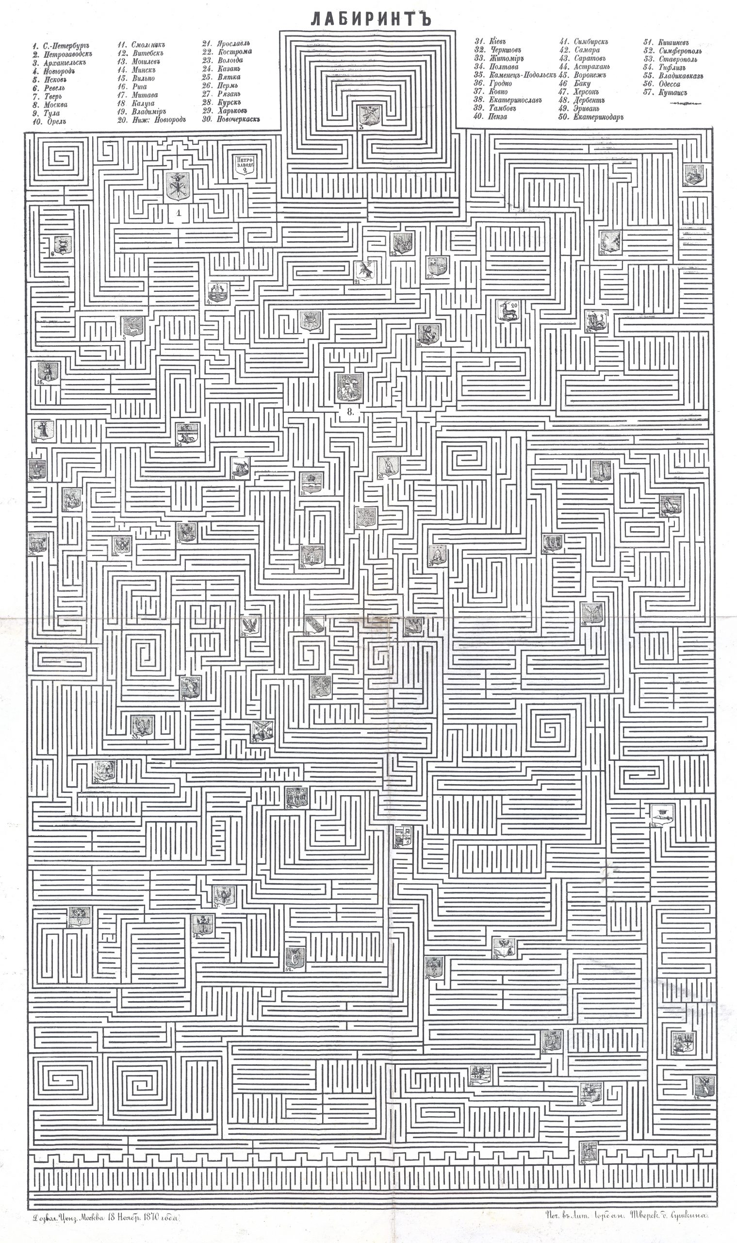
This Russian maze is a lithographed game dating from the 1870 Russian Empire. It was printed on paper (71 x 47cm) in the Tver region, north of Moscow. It includes the coat of arms of 57 major cities of the Russian Empire, all numbered. Besides being a maze game, it is also a kind of map as the Russian cities are located on the leaf in accordance with their geographical position. The most northern (Number 3) is Arkhangelsk and Erevan (the current capital of Armenia) is the one furthest in the south, number 8 is Moscow and number 31 is Kiev.
You can easily print it and try to go through all the cities. Help yourself with a map, this list of the largest cities in the Russian Empire in 1897, and this list of Russian Empire cities in 1840.
No comments yet — be the first to share your thoughts.